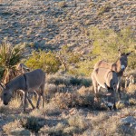
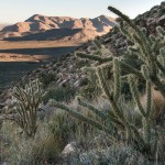
After a conference in Las Vegas, Ray and I spend a few days exploring the Red Rocks area and desert west of the city. It’s a fantastic place, and a completely different world from the fake and glitzy and ridiculous strip that’s the reason most people go to Vegas.
Sunday. The weather is cool but sunny and we rent mountain bikes from the hamlet of Blue Diamond, south-west of the city, and cruise around the desert. Lots of stunning yucca trees, but only in certain areas. The riding is fun and casual, mostly single track, some loose rocks. We head across the highway (160) and go around Dead Horse Loop. The climb west doesn’t look like much, but Ray and I are gasping by the time we reach the top and then head south. We cruise south, traversing some foothills on single-track and dropping back into the valley to hit a road and climb up to a minor pass. The road is soft dirt, covered with baseball sized boulders, and exhausting to ride; neither of us make it up. At the top of the pass we head east and north again, skipping the final section of the loop because its getting late. The next section is described as the “three mile smile” and it does not disappoint! Smooth single track, swooping turns, and a gentle grade downhill means fast, twisty fun. Going through some bushes quickly, I’m completely surprised by a built jump on the exit of the corner that was hidden by the bushes. Slam on the brakes and yell, which gives Ray time to slow down, but I go over the jump, a one-foot ramp, and land on the front tire but no crash. Whoa!! Ray comes around the corner, slow enough to avoid the jump, and we laugh about it as some trick played on the tourists.
The bikes we rented are 29″ wheels, and I’m surprised by the smoothness of the ride, as they easily go up 3″ steps without any real effort, not even needing much of a lift. We get back to the highway with enough time to climb the pass leading back to Blue Diamond, but there are three trails in the valley, unsigned, and it’s not clear which one leads up to the pass. On the way up, Ray dismounts and steps onto a large cactus, jabbing and scraping his knee badly. He’s bleeding a bit, but we continue on as it’s getting near dark. At the top of the pass, we realize that we are not on the right trail, but cannot get where we need to be, and after studying the map head west, hoping to hook up with the main trail. The sun has set, and we have about 1/2 hour of light left. Discussions on whether to head back down to the highway or push on this trail, which looks to be looping around west and north. Push on for 5 more minutes, and see the connection to a descending trail that drops into town, which we can see clearly from the ridge. My phone rings; it’s the bike shop wondering where we are. I tell him that we are about 30min out. We pick our way carefully down – the trail is loose and rocky – in the growing darkness and get to the bike shop with about 10 minutes of light left. Of course, we both had headlamps and extra clothes, so I was never really worried, but it was a little too close. Back home, shower and change and hit the Outback Steak House for dinner and beer, right near the hotel.
Monday. Climbing in Red Rocks with a relaxed mid morning start. Beautiful area and super fun climbing on solid, brilliant red sandstone. Neither of us have climbed much this year, and we do a 5.7 face climb, a 5.6 arête that’s mostly friction, then a 5.5 trad corner and finish with a 5.8 face that I end up climbing twice. 2nd time I’m more focused on speed as the route is near vertical and hands are getting tired. Fun!
Stop for dinner at a brewpub on the west edge of the city (across from Red Rocks Casino on Charleston) and then drive back out to red rocks so I can take some night photos. The sky glow from the city is quite strong, but it also illuminates the mountains nicely. It’s cold at night, quickly dropping to near freezing, and I take a few nighttime panos and then head back to clean up and have some beers at the steakhouse. Minimizing the orange sky-glow turned into an interesting post-processing challenge back home on the computer, but I’m happy with the final image.
Tuesday. Last day of this super quick but intense holiday. Getting up early, we go to scramble Black Velvet peak, at the southern end of red rocks, off of highway 160. Take our rental truck up a gravel road north from the highway, through two washes, and walking by 9:15, and with the guidebook saying 6-8 hours for the loop that should get us back well before dark (around 5) and time enough to clean up, pack up, and grab some food before my flight at 9. Ray is flying out tomorrow morning.
The hiking route goes across the desert, full of the the giant spiky cacti and the tall branched ones, but none of the yucca trees that were so plentiful on the drive in. We then enter a canyon, with a towering 2000′ wall to the south and a steep, undulating mass of yellow sandstone to the north. The canyon bottom where we are hiking is full of massive boulders, car to house sized, and for a km or so the way involves constant route finding and scrambling over these sandstone giants, as well as careful traversing across smooth sloping ledges above stagnant water pools left behind from the last storm. Beautiful, very unique and great fun! We work our way through the deep canyon and it then climbs steeply, still through a continuous boulder field, before exiting the canyon by scrambling up smooth sandstone to a series of ledges and then into rubble.
We’ve been in the shade all day so far, and the temperature is cool but we’re moving quickly, working hard and so not overheating at all. Exiting the ledges there’s a square window in the sandstone with a view out across the desert of the city. Near the top of the summit ridge is the Keystone Fault, and the rock turns from yellow sandstone to limestone. Working our way along the ridge we circle around the steep drops into the heads of canyon branches on a faint trail through the limestone rubble, and then we’re back onto sandstone as we get onto the ridge and head towards the first summit.
The sandstone is blocky and falls steeply off into the canyon far below, but route finding is relatively easy as the way is well marked by cairns. A steep ramp leads up to a hole in the yellow sandstone that we need to take the packs off to squeeze through and then chimney-climb out of, and Ray is having great fun as this reminds him of his caving days.
Out of the hole, traverse around the summit block across a very exposed but good ledge and then we’re on top. No time to dally and we head down the ridge towards the middle (highest) summit. Quick break on top and we decide to skip the third summit so we can get down in good time.
The route description takes us east down a ridge to a well-marked and very steep descent to the NE. The descent trail goes down through very steep but easily traveling sandstone until about halfway down where we traverse left to avoid a large cliff and end up on funky, blobby sandstone which is easy and fun walking down. The cairn trail now takes us into a gully and steepens again, with regular large boulders and smooth, sloping corners to work down.
The steepness eases off as we get down to valley floor, and the branched cacti and yucca appear again as we walk back to the car. The desert is full of beautiful plants, and the sunset on the red rocks to the north is stunning. Despite the rush back to town, there’s a few photo stops… Back to the car just before 4:00, so about 6.5 hours, moving mostly without breaks except for photos and half of lunch. Made the flight too!
2012, Darren Foltinek, with Ray McGarry


