Moab is one of my favorite places anywhere. Stunning geology, lots of empty space and a wide variety of activities including hiking, biking, paddling, skiing make it a place I keep going back to.
So last spring, when Kathy talked about a trail race in Moab taking place in February, I was all over it! I’m not a runner, but her race, combined with meeting up with friends, made a fine excuse to go down there for a visit. Friends Marc and Mel have been in Boulder, Colorado for a couple years, and it was high time for a visit. There were quite a few runners coming from Calgary, and we all flew to Denver, spent a night with Marc and Mel, then piled in rented cars for the 6 hour drive to Moab.
The drive from Denver to Grand Junction, Colorado on I70 is very scenic, climbing up and over the Rocky Mountains, through the mega ski resort of Vail, and down through Glen Canyon.
West of Grand Junction the landscape becomes desert-like; dry and barren. Turn south onto highway #128, following the Colorado River into Moab, and then after an hour or so the scenery quickly becomes very dramatic, as the river carves into the red sandstone the area is famous for. Soon we are surrounded by towering cliffs and dramatically eroded landscapes, all in surreal red.
We arrived in Moab Friday afternoon and settled into our rented condo. Kathy wanted to prepare for the race the next day, but Marc, Mel, Nivea and I (who were NOT running!) were keen to get out for a little evening hike. We hiked up Moab Rim, and the views and sunset light did not disappoint!
Race Day, Saturday
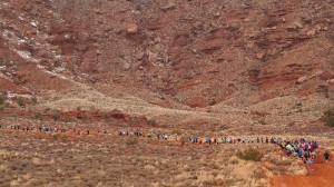
The race is the called the Moab Red Hot 55k and being more than 50kms is an “ultra” marathon. The morning was cool and rainy, which is certainly not bad weather for running, but makes for a chilly start. I ferry Kathy out to the start, help her warm up and get ready, and very soon, blam!, they are off!
The start is at Gemini bridges, and the weather is cold, wet, and windy. Kathy writes: the first 20k or so was nice as I got chat with folks because we were still clumped into groups as we ran along the 4×4 road. At one point there were 8 of us running and chatting. The course started with a climb up to the top of the Poisen Spider Mesa, which took about 1.5 hours. At the top of the mesa we were on slickrock, which was technical running – off camber and rock ledges, but with a beautiful view of Arches NP.
Kathy on the run: There were 3 aid stations on top of the Mesa, well stocked, and with friendly volunteers. I tried to eat a pbj sandwich but was not ready. Between aid stations 3 and 4 was the most cardio-challenging climb, over slickrock with ledges and holes. Reaching aid station 4 I felt my legs were done. Very done, but OMG I have a long way to go! There was one more station and 20km left to go. People were still around, but not as chatty anymore as everybody is in pain. Between (aid stations) 4 and 5 there was about 10km of nice road where I could run my legs out a bit, as the tecnical difficulties were not there. After station 5 was a difficult descent over slickrock, ledges that required sitting, sand and off-camber. Difficult route finding, but the trail was very well flagged. I met Fred and Heather at #4 and we started running together since Fred had run the race before and could find an efficient way through the slickrock. Fred and his wife run a pizza shop in Moab. We lost Heather, and I stayed about 10 paces behind Fred because I didn’t want to chat anymore. Digging deep! Fred was very supportive, which was nice because I was in a “just kill me now my legs aren’t working” state of mind. What was excellent was that my cardio was always good – never short of breath, gasping or panting. My legs were tired after 20km, and near the end I was placing each foot with extreme care, and had to stop at difficulties. Seeing Gord and Jen at the finish line I got a bit teary. There was no soup, beer or support people left; I’m usually in the middle of the pack, and it was a good reminder to stick around for the last people in the race because they are really hurting!
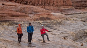
Darren: Because the race wandered all over the Moab Rim mesa, there was no easy way to get out there and take pictures of the runners, so Marc, Mel, Nivea and I went for a hike, planning on meeting up with the runners at race end. We went to the Needles area of Canyonlands, which was a bit of a drive, south of Moab and then through Indian Creek, and ended up doing a meandering hike in misty, rainy weather. The needles area is beautiful, and the rain made the rock colors more intense, and kept the temperatures comfortable.
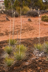
The desert foliage is fantastic, surviving droughts and scorching heat, as well as what we experienced today – cool and wet, with an occasional downpour that quickly formed streams and small waterfalls flowing over the sandstone.
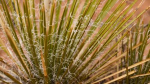
Started off in the desert area full of the famously fragile cryptobiotic soil, Yucca plants, barrel and prickly pear cactus. Mel was pointing out winter oak as well as numerous other dessert plants to us. We dropped into the canyon and the vegetation changed dramatically to cotton woods and reeds, grasses and scrubs. The bottom of the canyon is a much more lush environment as that is where the water is. The hiking trail takes us around the bottom of the canyon and then, as we hike up onto the slick rock slopes traversing a butte, the rain starts as a gentle mist. As the rain picks up the slick rock, which is sandstone, surprisingly does not get slippery. At one point we come to a small steel ladder, which has a waterfall cascading over it from the rain. Off the slick rock of the butte and down into the canyon, which is a wandering maze of vertical walls. Not sure where we are, we discuss and consensus says go right. Mel makes reference to a low budget horror film: if you find yourself in the same spot an hour later you are screwed! And yes, after half hour we find ourselves in the same spot again. This time we go left, and figure we are at the “lost” part of the aptly named Lost Canyon.
Unfortunately, the combination of the long drive and our getting lost in the desert meant that we didn’t make it back to Moab for the end of the race! Felt bad about that – Kathy certainly could have used some support at the end of that incredible distance.
Canyonlands Hike, Sunday
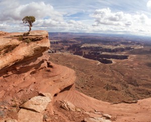
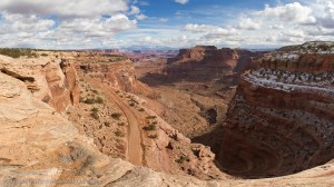
Sunday was a recovery day for the runner folk. After that distance, no kidding! We drive west of Moab then south to the Grand Viewpoint in Canyonlands National Park. The rim where we hike is at 8000′ and the Colorado and Green rivers flow far below, at 4000′. From this viewpoint we can see the White Rim but not the rivers themselves. Amazing! Marc and Mel, who have spent the most time in Moab, recommend the White Rim road, running along a bench of rock about half-way between the upper rim and rivers, as a fine place to explore later this week. Then Gord and Jen and CJ leave, as do Chris and Hugh, back to Calgary.

The gang: Jitka, Jeremy, Mel, Marc, Gord, Jen, wee CJ, Kathy, Darren, Nivea at Canyonlands Grand Viewpoint
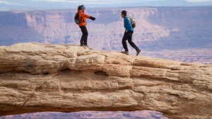
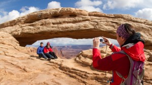
The rest of us then drive back and stop at Mesa Arch, which is at the edge of the canyon overlooking the Colorado river. Marc immediately jumps up on the arch and walks across it, with Mel joining him. Cute. We later discover that the arch is completely detached on the north side, and balanced on a precarious point. Walking on it doesn’t seem such a good idea anymore! Everybody takes turns posing inside the arch for pictures – there are no crowds – a big advantage of being at this most famous of places in the low season of February!
Arches National Park, Sunday
We then drive to Arches NP for a partial tour, stopping at Wall street area and then moving to the Windows area where we do a short hike behind the twin arches.
It is very difficult for Kathy to walk, and she needs help to get down even small steps, for which she is teased relentlessly. Yuk, yuk. She’s a trooper though and does the whole loop. The sky is partially cloudy and has the potential for a nice sunset – I bribe Marc, Mel, K and Nivea to hang out and wait for sunset. I run over to the double-arch area in windows and some magic light illuminates the walls and area. Snap snap.
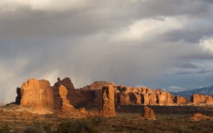
We then drive to a picnic area close to Balanced Rock and Marc leads us on a short hike to a slick rock viewpoint overlooking the whole windows area. A storm is rolling by, overtop of the La Sals – stunning! Snap snap. Kathy soldiers on and with help gets up onto the rock ridge and we all enjoy the sunset – a magical time in a magical place!
Rest day in town, Monday
Monday morning most folks leave for Denver and K and I are left to explore Moab. Kathy still needs help walking, but is improved from Sunday. Gentle walking is what she needs, so we walk the town, stopping in galleries and shops. Lunch is a yummy veggie sandwich at The Love Muffin cafe, a very cute place. We stop by bike shops looking for rentals and find two great bikes at Poison Spider. Also stop at a fun rock and fossil shop at the north end of town. South of town are the La Sal mountains, rising to 14,000′, and it’s been a dream of mine since my first Moab visit to explore them. We drive up the La Sal Mtn road to check out access this time of year and get the little rental car, “Rev”, to the first trailhead on the Geyser pass road, and make a plan to head up a ridge towards Mt. Tukuhnikavatz on skis later in the week.
White Rim bike, Tuesday
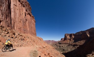
Tues we rent bikes: Konas named Riley and Houdini, brand new full suspension bikes. Sweet! Houdini is a Kona Cadabra with a fancy dual-travel rear suspension. After much putzing about with the bike rack, we drive to Canyonlands and ride down the amazing switchbacks of the White Rim road.
Constantly stopping to take pictures as each corner seems more amazing than the last. Kathy sees a mountain sheep, and we get pictures of two of them as they spook and run away.
We ride out past the potash road junction to a hiking trail leading to a viewpoint of the Colorado river and hang out among the tottering white rim rocks. It’s late afternoon and Kathy suggests hanging out until sunset – great idea! – but it will take us at least 2 hours to ride back, gaining the 1000+ feet up the switchbacks.
After finding a way down just below the rim and exploring down there, then getting back up to the white rim, more photos and snacks, we have spent over an hour here and it’s time to leave.
The flat dirt road is soft and sandy, which makes the riding a slog unless moving quickly so that you can stay on top of the sand. Up the switchbacks is an endless granny-gear climb. Surprisingly, despite the t-shirt and shorts weather, there are snow patches on the shaded north-facing parts of the trail, and occasionally a tire breaks through the snow. Just past the last switchback we see the two mountain sheep again and then we are back at the car just as it’s getting dark.

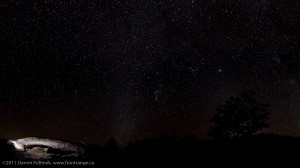
Mesa Arch Night Sky and Zodiacal Light, silhouetting the tree on the right, Canyonlands National Park, Moab Utah
It’s a beautiful clear night, so after loading up the bikes, we drive to Mesa Arch, just down the road, to watch stars. I discover that my headlamp has been on in the bag (!) and is now dead. Good thing Kathy’s is working, because the only light is starlight and the desert night is very dark. Cold too! We bundle up and walk the 10 minutes to the arch under a sky filled with brilliant stars as the last light of the sun fades, but leaving a glowing vertical band of light reaching up from the horizon.
I later find out that the vertical light band is the Zodiacal Light, formed by reflection of the sun off dust particles along the ecliptic. It’s a brilliant clear night! Setting up and shooting Mesa arch takes about 1/2 and hour, then we play around with light painting it, which works out well – I’m excited to see the early results. The darkness of the night is very deep, and we are both very mindful of the large drop, down into the canyon, just past the arch – an invisible void that you can feel as a empty silence, adding to the spookiness of the place.
After the “painting”, Kathy wants to go back to the car to warm up – we’ve put on warm clothes, including puffy down jackets, but the desert night is cold. I leave the camera gear – there is nobody out here to steal it! – and walk back to the car with her, then walk back to the arch, 10 minutes each way. Only one working headlamp… Walking back to the arch alone makes me wonder if there are any large cats around, the only danger out here other than wackos, so I pick up a big stick. I’m hoping that the moon will soon be rising, which will illuminate the ground nicely, but checking out the Starmap app on the iPhone (technology is great!) the moon won’t rise for another two hours, so I pack up and start walking back. Two relatively large trees along the trail inspire more light-painting… then I join Kathy in the car and we drive back to town after an amazing day and evening!
Amasa Back ride ‘n run, Wednesday
We still have the super-fun bikes today, so after a relaxed morning we cruise from the motel, riding down the road and along the Colorado River as it flows south into Canyonlands. The weather is beautiful, and the red of the rocks and blue of the sky are deep and rich.
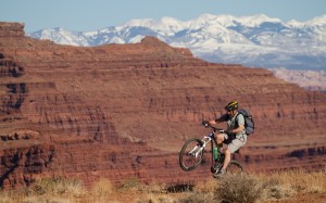
The Amasa Back trail starts off with a technical descent right from the trailhead, loose rock over drops that looked uncomfortably large to me. Not having done any real mountain biking in over a year, I sigh and walk the bike down the start. The rest of the trail was much more reasonable and super fun, mostly double-track, climbing up and around the mesa.
As we climb up the mess, the La Sal mountains come into view, forming a snow-covered backdrop to Back of Beyond, a closed area southeast of Moab.
Kathy much prefers two feet to two wheels, so she hid the bike and walked / ran the trail. I was amazed that we were almost the same speed, me on the bike stopping to take pictures and her hiking and running along on foot.
Makes me wonder what the point is of all that fancy, suspended, expensive, over engineered and market-hyped bike hardware is good for!
We have to hurry back to town to get the bikes returned before the shop closed, and so didn’t get to the top of the trail – next time!
The ride back to town from the trailhead was quick and beautiful. The sight of blue skies over red rocks never stops being stunning!
La Sal Mountains Ski, Thursday
In my trips to Moab, I have always wanted to get out and explore the La Sal mountains, but somehow it’s never happened. That’s about to change! We coax the rental Mazda up the La Sal pass road, which climbs steadily up from Moab, deep in the valley. The road climbs higher, and soon we are in a beautiful pine forest, and the road is starting to be snowy. The snow gets deeper, and we pull over and park before getting the car, with it’s all-season tires, stuck. And then we’re putting skins on the skis and touring up the trail.
As we climb above treeline, the snow turns very hard from being blasted by the wind, and we leave the skis behind and just hike up. The views down into Canyonlands are fantastic!
We are approaching 12,000′ elevation, the top of the canyons are around 8,000′ and the rivers are at 4000′. That’s a lot of vertical relief! The air is getting thin, it’s windy and quite cold – an incredible change in climate from yesterday when we were biking in shorts and T-shirts in the canyon below!
We get to the top of “Little Tuk” and then it’s time to descend, walking back to the skis and then cruising down, finding some good turns through the forest and back to the car. What a treat to mix hot desert biking and backcountry skiing in the same week!
Running, biking, hiking, skiing and amazing scenery – Moab is awesome and Kathy you rock!!
Darren Foltinek, 2011


